


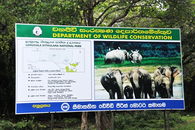
Lahugala Kithulana National Park
 |
|
| INTRODUCTION | Biogeographical Province 4.13.04 ( Ceylonese Monsoon Forest) Geographical Location Lies in the basin of the Heda Oya , 16k inland from the coastal town of Pottuvil in Eastern province . The Pottuvil – Monaragala trunk road runs through the south eastern sector of the park . 6 53’- 6 55’N, 81 40’-8142’E Date and History of Establishment Created a national park on 31 October 1980, having originally been established as a sanctuary on 1 July 1966. |
| ACCESS |
|
| PHYSICAL CHARACTERRISTICS | The terrain is flat with occasional rock outcrops . The park features three tanks, lahugala (243ha) , Kitulana and Senagamuwa , which ultimately drain in to the Heda Oya . These tank s are largely silted up and support an abundance of beru grass. Climate Mean annual rainfall is 1650mm (McKay, 1973). There are two dry periods: from May to October and from mid- January to March . The north –east monsoon lasts from November to the end of December (Banks and Banks , 1985).
|
| VEGITATION | Lying in the dry zone , the vegetation surrounding the tank is dry mixed evergreen forest with scrub. Common species include weera Drypetes sepiaria , palu Manilkara hexandra, halmilla Berrya cordifolia, milla Vitex pinnata, satin Chloroxylon swietenia and ehala Cassia fistula. Beru Sacciopelsis interrupta, a tall reedy grass , covers the tanks. Rivers are fringed by gallery forest. |
| FAUNA |
|
Copyright ©2014 Department of Widlife Conservation in Sri Lanka